The launch of “Wildbore: A photographic legacy” on Wednesday night was an amazing success, with over 80 people attending, including around 20 people from the wonderful Wildbore clan. Thank you all for coming along and making it such a successful and enjoyable event. Here are some photo highlights.
Wildbore

Pohangina wetlands: Wildbore cache no.22
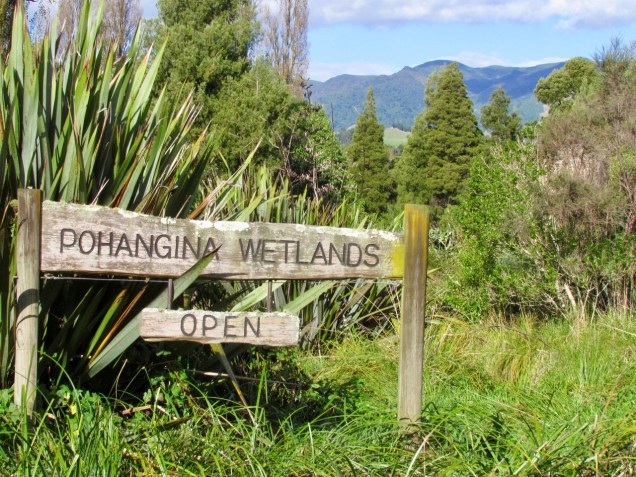
While researching the clues for a cache at Pohangina wetlands the other day, I stumbled across this not-so-fun fact: scientists estimate that more than 98 of percent of kahikatea forest, which grew in lowland, swampier areas, has been lost nationwide since European colonisation of New Zealand. In the Manawatu region, where wetlands once covered much of the river plains extending from Palmerston North out to the coast, more than 90 per cent of wetlands have been lost. This is a tragic legacy of European settlement, but also makes the Pohangina Wetlands all the more special. Continue reading
Share this:

Exploring our history through the wonderful world of geocaching
A window into the long lost, densely forested lowlands of Manawatū has been opened by an author using antique glass plate negatives and new geocaching applications.
Pohangina author Catherine Knight’s main focus is environmental history which led to her fourth book Wildbore: A photographic legacy.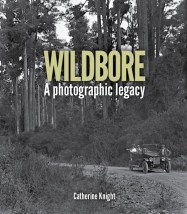
Read the remainder of the story and watch the video on the New Zealand Herald website.
For more information on Wildbore: A photographic legacy (Totara Press), including where to purchase it, go to the Totara Press webpage
See also: Wildbore geocache no. 1: the school that moved, “Ghost bridge” – Wildbore geocache no. 2, Hauling logs over the Awaoteatua Stream – Wildbore geocache no. 3, or search for posts using keyword “geocaching”
Share this:

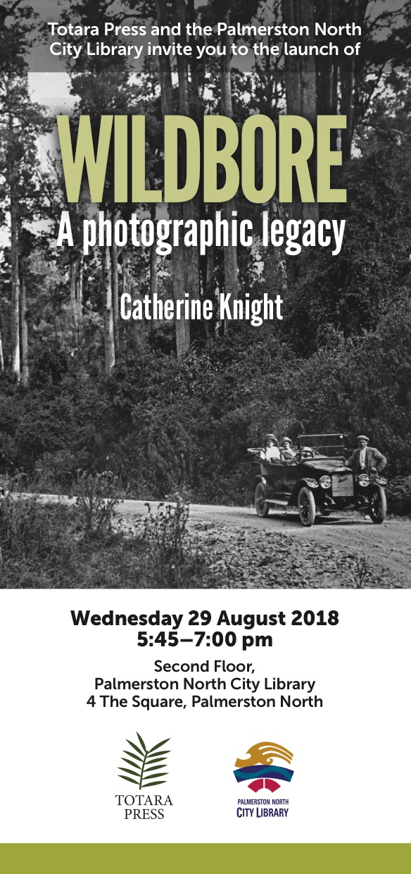
You are invited to the launch of “WILDBORE: A photographic legacy”
Share this:

Totara Reserve: from exploitation to preservation
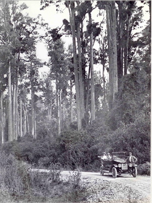
Totara Reserve is situated in the Pohangina Valley on the eastern side of the Pohangina River, in the Manawatu [click here to view location]. It encompasses an area of 348 hectares, much of it podocarp forest, made up of totara, matai, rimu and kahikatea, as well as some black beech.
Its history as a reserve began in 1886, when it was gazetted under the provisions of the State Forests Act (1885) as a ‘reserve for growth & preservation of timber and for river conservation purposes’. This at a time when the area was been ‘opened up’ for settlement – settlement in the Pohangina Valley area began with Ashhurst in March 1879.
In 1932, a portion of the Reserve was designated as a Scenic Reserve under the provisions of the Scenery Preservation Act 1908, and vested in the Pohangina County Council. Continue reading
Share this:

Scorched forest farm – Wildbore cache no.7
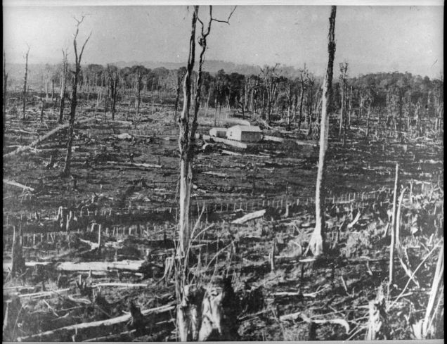
Number 7 in the Wildbore geocache series is on No. 1 Line on the eastern side of the Pohangina Valley. It was on No. 1 Line that Charles E. Wildbore took one of his earliest surviving landscape photographs, in 1896. The photograph starkly captures the brutal transformation of the landscape by fire. A farmhouse is surrounded by the incinerated limbs and trunks of the forest trees, that until only a few years previously covered the hills and river terraces of the entire valley. While we cannot see this from the photograph, this would likely have been a landscape of oppressive silence – any birds that were able to escape the conflagration would likely have taken refuge in the nearby Ruahine foothills, while introduced birds, such as the sparrow, thrush and blackbird were yet to colonise the valley in substantial numbers. Continue reading
Share this:

Can you help solve the mystery behind this photo?

Can anyone help us track down the original print (or even better, the negative) of this photograph? Continue reading
Share this:

The church that moved: Wildbore cache no. 4
 The fourth cache in the now “Wildly-Famous-in-Pohangina” Wildbore geocaching series is at the top of Church Hill, near the site of the eponymous church.
By the end of the 19th century, the population of Awahou, on the eastern side of Pohangina River, had grown to a healthy number, and the community felt it was high time for a church to service the Awahou community.
St. Aidan’s Church was opened in November 1902, a modest but attractive timber church accommodating 74 people. Continue reading
Share this:

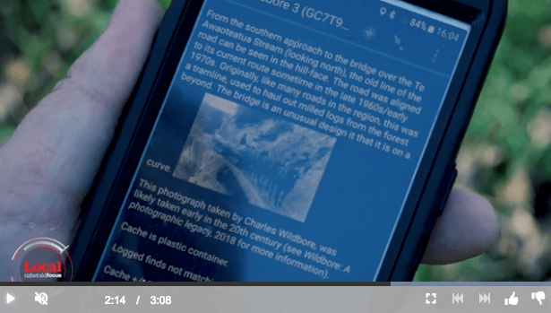
Hauling logs across Te Awaoteatua Stream: Wildbore cache no. 3
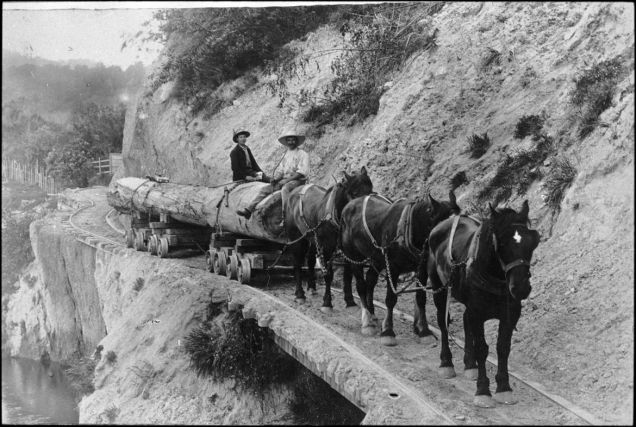
The third cache in the Wildbore geocache series is hidden near the site of this photograph, taken by Charles E. Wildbore, showing two Valley men pulling a milled log across the Te Awaoteatua Stream bridge at the bottom of Church Hill, Awahou.
The road down to the stream was realigned in the late 1960s/early 1970s, but it can still be seen in the face of the hill when looking north from the bridge (it is also visible as a contour in Google maps). Continue reading
Share this:

“Ghost bridge” – Wildbore cache no. 2
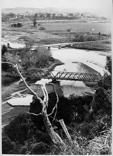
Those who have travelled up the eastern side of Pohangina Valley, to visit Totara Reserve, for example, will have crossed the Raumai Bridge. Those with more life experience may also the old Raumai Bridge, a bridge with a troubled past. Continue reading

