The Hautere seagulls

Hautere 1
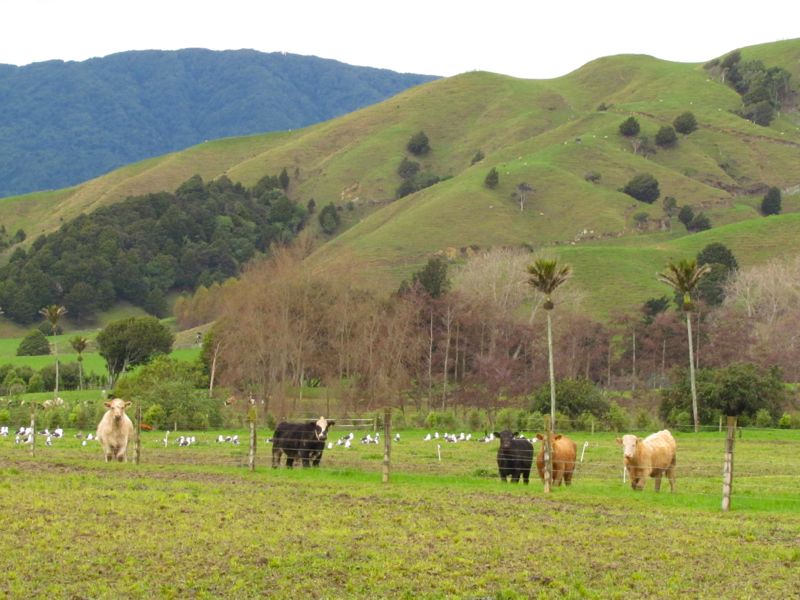
This is a farming landscape that captured my attention while driving along Te Horo Hautere Cross Road yesterday.

This particular location is “Hautere”, just inland from the better known location of Te Horo. We know Hautere by its stone “turnips”, likely brought down from the ranges from a once more powerful river. Continue reading

The “Hautere Turnips” of Te Horo

Driving through Te Horo recently, on the Kapiti Coast, I was fascinated by the number of stone walls, stone cairns, and stone piles evident in the locality – more reminiscent of my image of the English countryside, than of typical rural New Zealand. I sensed there must be a story there, and I was not disappointed. Continue reading

What is cute, furry and ecologically devastating?

Answer: a possum.

Even this little fellow, still not fully grown, would wreak havoc on vegetables and fruit trees, and in an indigenous forest environment, shrubs, trees, bird young and eggs.

Recently, we stayed at our friends’ lifestyle block near Tokomaru, nestled in the foothills of the Tararua Ranges [click here to view map]. Continue reading

Hidden treasure at Otaki Gorge

An after-dinner drive today led to a fascinating discovery. My husband and I drove up Otaki Gorge Road [click here to view map], a beautiful scenic road that follows the Otaki River up towards its source in the Tararua Ranges. In many places there are stands of totara which some past landowner with some foresight decided to spare from the scourge of milling and burning that destroyed all trace of most of the other plains forest.* Continue reading

Views of Kapiti 7: Morning mist over Hemi Matenga

A view of the Hemi Matenga hills, which overlook the town of Waikanae, taken from Elizabeth Street, eastern Waikanae. Low morning cloud shrouds the hills, threatening rain, and creating a sense of drama and mystique. Continue reading

Protest on the landscape – Wallaceville, Upper Hutt

This dilapidated shed, on Wallaceville Road, south of Upper Hutt [click here to view location], has now come to serve a purpose beyond its original one of a wool shed – a protest banner against 1080. Continue reading

The legacy of G. L. Adkin – keen “reader of the land”

The fact that the Horowhenua district has such a rich written and photographic history, as well as ethnographic, archaeological, cartographic and geological record, is almost wholly down to one man – a Horowhenua farmer and irrepressible self-taught scholar of geology, archaeology and ethnology (as well many other subjects). Indeed many of the photographs used on this site are the work of this highly methodical and observant man who took his camera everywhere – including up the Tararuas on numerous exploratory expeditions to map, make geological observations, rescue lost trampers or simply for adventure.

George Leslie Adkin was born in Wellington on 26 July 1888, the first of seven children of William George Adkin, a draper, and his wife, Annie Denton. Continue reading

View of Tararuas from “the land of the great landslide”

This photo is taken from State Highway 57 on the south-eastern side of Levin, in the southern North Island district of Horowhenua [click here to view approximate location]. In the foreground sheep graze, while the in the background, the bush-covered foothills of the Tararua Ranges, then the Ranges themselves – capped with a light sprinkling of the first winter snow – can be seen. Continue reading