Thanks to the support and enthusiasm of lots of organisations and people around the motu, we have managed to lock in dates for events organised so far:
29 July – national (online), Wellbeing Economy Bookclub
9 August – Paekakariki, Kapiti Book Festival
12 August – Christchurch, Scorpio Books
13 August – Timaru, South Canterbury Environment Centre
14 August – Dunedin, Centre for Sustainability, University of Otago
27 August – Matamata, Transition Towns
28 August – Hamilton, Rototuna Public Library, in partnership with Go Eco (Waikato Environment Centre)
17 September – Wellington, Sustainable Business Network member’s event
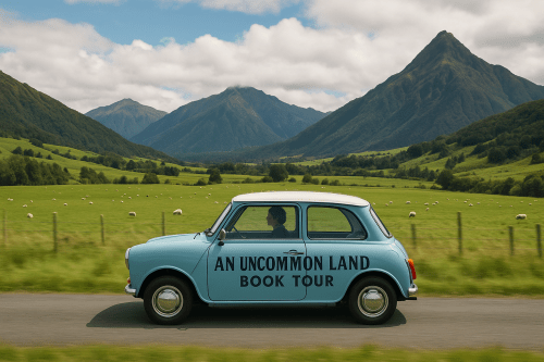
Will the ‘An Uncommon Land’ book tour be the biggest thing to hit Matamata since Hobbiton?
In addition to these confirmed events, I am in the process of planning events to be held in the following centres:
Wellington (public event)
Auckland – in partnership with University of Auckland and Deep Green Aotearoa
Palmerston North
Hawke’s Bay
Gisborne/Tairawhiti (this may be online)
If you would like to help partner on, host, or otherwise support these events, please let me know. You can contact me via message on Substack or via my website.
Find out more about An Uncommon Land here. Read the media release here.
Crowds at the VE Day celebrations, Parliament Buildings, Wellington, 1945. Alexander Turnbull Library.
Just when we thought there was nothing more to destroy, the government continues its unrelenting assault on our commons. This time our knowledge commons – our knowledge of our own history.
Manatū Taonga Ministry for Culture and Heritage has announced plans to disestablish the majority of its historian positions and get rid of the digital production roles essential for maintaining platforms such as Te Ara Encyclopedia of New Zealand and NZHistory.net, which are a vital source of information about our history utilised by students, researchers and the public. (They are an invaluable go-to for researchers and writers like me.)
This will effectively end decades of vital public history work. These cuts constitute a serious threat to New Zealand’s capacity for historical research, education, and public engagement at a time when such work is more crucial than ever.
This is what three of New Zealand’s leading historical organisations have to say:
PHANZA, NZHA, and NZHTA* express profound alarm and deep opposition to the proposed restructuring of MCH. The changes threaten to dismantle decades of world-class historical scholarship, shutter vital resources for history research, and harm public education. The proposed elimination of historian positions catastrophically reduces the ability of New Zealanders to preserve, discover, and share their stories.
*Professional Historians’ Association of New Zealand Aotearoa, New Zealand Historical Association and New Zealand History Teachers’ Association. See their full statement at this link.
If you care about our history and believe that the government should too, here are some things you can do:
Write a statement in support of MCH’s historical work to be included in the PSA’s decision and send it to Grace Miller (contact person at the PSA for the historical community on this matter) at grace.millar@psa.org.nz.
Please be aware, I no longer post regularly to this site. For more regular updates, particularly on themes traversed in my latest book An Uncommon Land, please subscribe to my Substack ‘An Uncommon Land‘ – it’s free!
It has been a busy couple of months, getting my new book ‘An Uncommon Land’ edited, designed and laid out and then checked, re-checked, and triple-checked ready for printing. It is now being printed, due to released by the end of this month.
So, what is ‘An Uncommon Land’ all about?
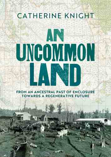
An Uncommon Land is a story of enclosure, dispossession, colonisation and – ultimately – hope for a better future. Through the lens of her ancestors’ stories, Catherine Knight throws light on the genesis and evolution of the commons, its erosion through enclosure and the ascendency of private property in parallel with the rise of capitalism – a history that has indelibly shaped New Zealand society and its landscape.
Like other European settlers, the lives and future prosperity of the author’s ancestors had their foundations in war, land appropriation and environmental destruction – but in their histories lie glimmerings of the potentiality of commons: tantalising hints of an alternative path to a re-commoned, regenerative future.
At this pivotal juncture in our history, we face unprecedented challenges caused by our exploitative actions towards nature and each other. But we have a choice: to continue along the path of untrammelled exploitation and exponential growth, or to reassess the way we engage with the natural world and the rest of society. From a past of enclosure, resource exploitation and denaturing, we could choose a path of re-commoning and regeneration, taking inspiration from our collective history.
My aim with the book is to invite readers into a conversation. A gentle invitation to reassess the world we live in today by reflecting on our own ancestral past. Is it really so radical to talk about a society which carefully regulates the use of common resources, lives within limits, and values social connection beyond the accumulation of material possessions, when these were natural features of own ancestors lives not so many generations ago?
The book will be available as a beautifully designed paperback book (thanks to my talented designer Matthew Kelly) as well as an e-book. More details on my website and a downloadable flyer here. Can be pre-ordered from Nationwide Book Distributors.
There will be no formal launch, but I would love to hear from groups or organisations wishing to host author talks, panel discussions or similar exploring the themes of commons, enclosure, regenerative economy or post-growth paradigms – this could be standalone, or alongside other authors or thought-leaders – all proposals considered! Feel free to contact me via Substack or via my website.
An exciting announcement! The award-winning ‘Ravaged Beauty’, which is once again approaching sold out in hardcopy, is now available as an e-book.
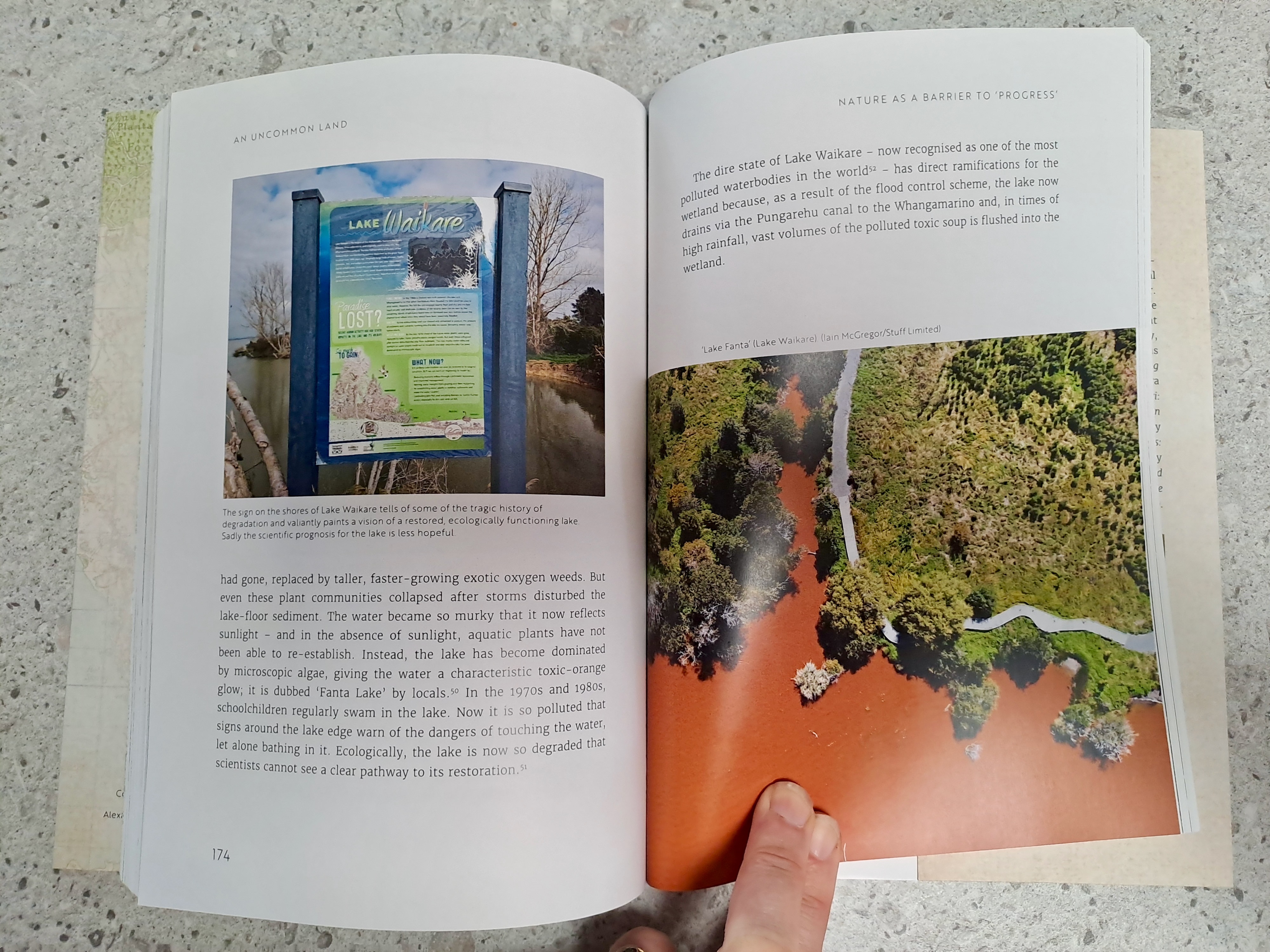
Before the arrival of European settlers in the late 19th century, the Manawatu Region of New Zealand was a heavily wooded hinterland, its forests ringing with the sound of birds, its abundant wetlands teeming with fish and waterfowl. But within a few decades, the forest had been reduced to ashes; the swamps and lagoons were being drained away. Progress marched across the landscape in the form of farms and settlements.
It wasn’t long before nature exacted its revenge: erosion scarred the hillsides, floods ravaged farms and towns. Pollution of the rivers saw fish dying en masse. How would people meet these environmental challenges, and what lessons would there be for the future? Drawing on a rich array of sources, maps and photographs, Ravaged Beauty tells the story of environmental transformation – part of the great tide of ‘progress’ that touched every corner of the globe – with consequences that continue to reverberate today.
Exploring enclosure, colonisation and denaturing through an ancestral past, towards the possibilities of a re-commoned future
This week, after about four years of working intermittently on my latest book ‘An uncommon land’, I handed over my manuscript to my trusted editor. I have been released (for a while at least) from the research and writing that has been all-consuming over the last months. This is when the exciting phase of transformation begins: taking pages of painfully pored-over words and a ragtag collection of images, and crafting them into a book. And, I get to start talking with people about the ideas and reflections that have until now been confined to my mindscape and to the Word doc on my screen.
‘An uncommon land’, the title of my book, has dual meaning – one meaning that points to the past, and one meaning that points to the future. I will expand on this in subsequent posts. But, as a taster, here is a blurb about my book:
‘An uncommon land’ is a unique exploration of New Zealand’s history using the experience of the author’s ancestors as a lens. In this engaging and richly illustrated book, award-winning author and environmental historian Catherine Knight throws light on the genesis and evolution of the commons, its erosion through enclosure, and the ascendency of private property in parallel with the rise of capitalism – a history that has indelibly shaped New Zealand society.
Like other European settlers, the lives and future prosperity of the author’s ancestors had their foundations in war, land appropriation, and environmental destruction, but in their stories there are also glimmerings of the potentiality of commons – tantalising hints of an alternative path to a re-commoned, regenerative future.
This book comes at a pivotal juncture in our history: the last two centuries have been characterised by land enclosure, the unconstrained destruction of nature, and capital accumulation. As we face unprecedented challenges caused by our exploitative actions towards nature and each other, we have a choice: to continue along the path of exponential growth, or to reassess the way we engage with the natural world and the rest of society. From a past of enclosure, resource exploitation and denaturing, we could choose a path of re-commoning and regeneration, taking inspiration from our collective history.
Over the next weeks and months, I intend to explore the themes traversed in the book through some short writings on Substack. The topics will be wide-ranging and probably somewhat random and unpredictable (even to me). I hope you will join me on this unpredictable, exploratory – and hopefully, thought-provoking – journey from the past into the vast potentiality of a different kind of future.
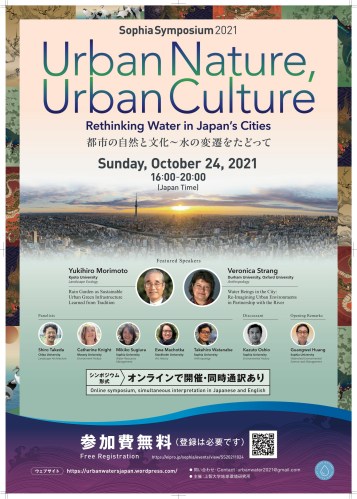
I am excited to be reconnecting with my Japanese ‘roots’ by being part of this upcoming symposium thinking about the place of urban streams in Japanese cities, environment and culture.
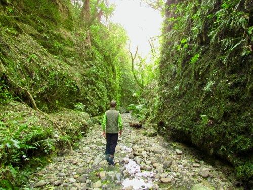
Last weekend, we entered a time machine, which took us back in time about 18,000 years to a much colder version of the Manawatu – the last glaciation period. And we did this by walking just metres from our house. We were fortunate to have as our time-machine guide Professor of fluvial geomorphology Ian Fuller.
This bit of time travel solved a number of mysteries that had drawn on my curiosity for some time.
As I have described in previous posts, to access our gully stream, we walk down a spur from our paddocks (on a river terrace), with sheer drops on either side. The top of the spur is made up of a loose mix of soil and stones, the sort of material you would expect to see on a river flood plain. But the spur is 20 metres higher than the current streambed – could the stream at one time been a surging torrent so voluminous it had scattered river gravel across the spur?
With an expert at our disposal (not literally obviously – we are nice to our guests!), we discovered the more likely explanation. Our river terrace, now tens of metres above the Pohangina River, was once the flood plain of a braided river, bringing huge quantities of greywacke rock down from the ranges in its wandering currents. This braided river flowed during the glacial maximum – 18,000 to 20,000 years ago, when glaciers was last at their maximum extent, and otherwise known as the last glaciation. Aotearoa New Zealand was quite a bit bigger then, and joined up as one island (see this map) – which would have been handy if there had been any people around to enjoy the convenience!
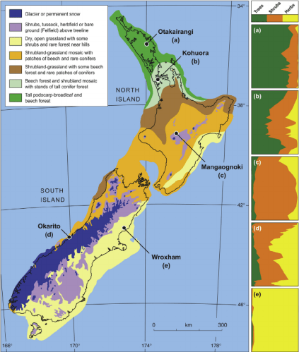
As well as being a lot colder, the landscape was quite different then – instead of the dense forest that greeted our island’s first settlers 700 or so years ago, the landscape was a mosaic of grassland and shrubby plants, with patches of beech and a few scattered conifers. See vegetation map from Newnham, Wilmhurst and McGlone (2013).
From Newnham et al. (2013). ‘The vegetation cover of New Zealand at the Last Glacial Maximum’, Quaternary Science Reviews
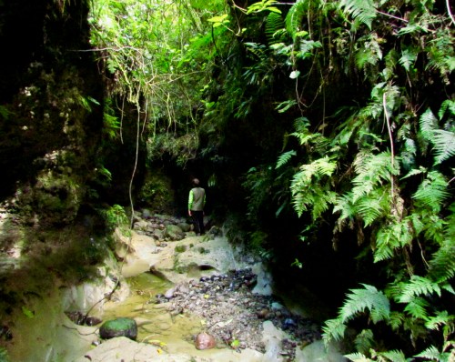
The second mystery that this bit of time travel solved was how a relatively small stream that can go dry in the summer months could have carved out such a cavernous gully of 20 metres depth. Well the answer, in very simple terms is this. As our islands started to warm after this last ‘cold snap’, the Pohangina River, which our stream is a tributary to, started to cut down into the soft mudstone land. As it did so, the stream also needed to cut down to keep up (or more accurately, down) with the river, probably through the gradual shifting of a waterfall into the river upstream, or, in fluvial geomorphologist language: ‘the mechanism was probably the headward retreat of a waterfall, initiated by incision of the main river’. … What I said.
Here, the stream has carved out pools in the mudstone.
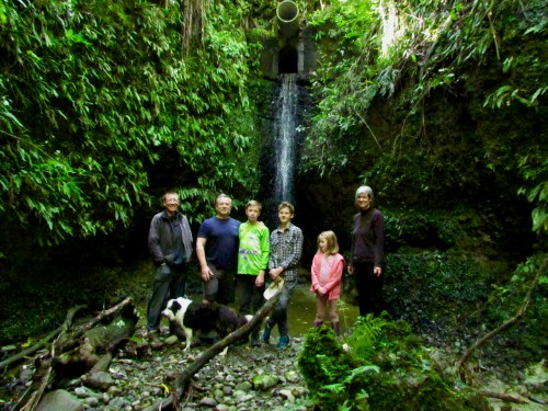
The exciting thing is, we still have that waterfall, though it now comes out of a concrete culvert rather than a natural channel. It is likely that it cut back to this place, an area of particularly hard and stable rock, and because of its relative stability, engineers chose this place to build the road over the stream a century or so ago, piping it through a culvert. Thus, the waterfall has been ‘frozen’ in time, unable to cut back any more.
The waterfall, now unceremoniously piped through a concrete culvert, thanks to roading engineers of a century ago
It is a daunting to have your work reviewed by someone as well respected in the field of environmental history as Graeme Wynn, Professor Emeritus in Geography, University of British Columbia. A relief to find it is a positive review, and an very nice indeed to read his assessment that “Catherine Knight is set fair to take her place among the country’s leading environmental historians”. Continue reading →
I will be taking the audience on a journey of discovery of the Manawatu’s past through the photographs of C.E. Wildbore and others. The event also marks the launch of Totara Press’s beautiful new (French-flapped) edition of Ravaged Beauty: An environmental history.
Wildbore: A photographic legacy will also be for sale at the event.


 It is a daunting to have your work reviewed by someone as well respected in the field of environmental history as Graeme Wynn, Professor Emeritus in Geography, University of British Columbia. A relief to find it is a positive review, and an very nice indeed to read his assessment that “Catherine Knight is set fair to take her place among the country’s leading environmental historians”.

