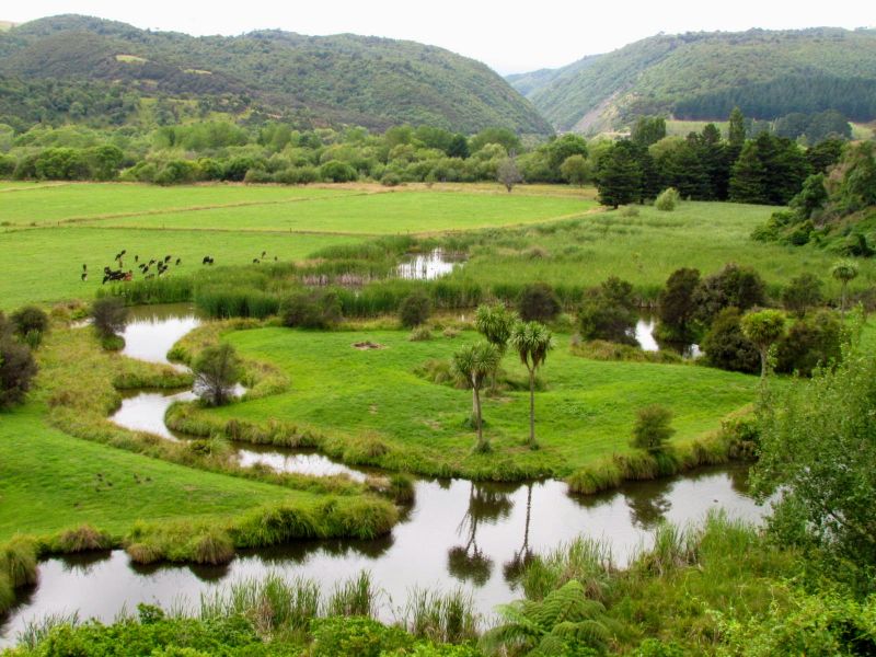
Though we often hear about wetland restoration projects, the Ashhurst wetland, on the river flats below the Ashhurst Domain [click here to view location] is not a case of “restoration” in the normal sense.
The site where the wetlands – a series of lagoon-like bodies, connected by a small stream to the Pohangina River – stand, was once actually the course of the river itself. The course of the river changed when an embankment was constructed alongside the railway between Palmerston North and Gisborne, sometime after 1872. (The map above shows the railway line skirting around the northern border of the domain, before heading south-east to pass through the Manawatu Gorge.)
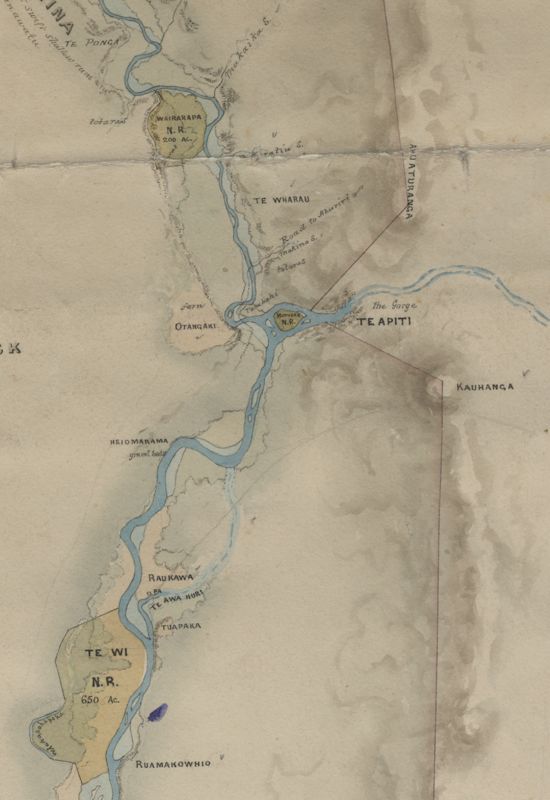
Adding to the history of this site, it is overlooked by the site of the Otangaki pa (fortified village), a former pa of the Rangitane iwi (tribe). It is thought that the pa sat atop the cliffs just above the wetland. With cliffs on three sides, this would have been an ideal position, providing a view over some distance of any oncoming attackers. It is not clear when the pa was abandoned, but it was recorded on J.T. Stewart’s 1860 map of the Ahuaturanga/Upper Manawatu block (see right). Note how the Pohangina River curves around to the west before joining with the Manawatu River as it exits the gorge (between the Ruahine and Tararua Ranges). The Pohangina River now follows a largely north-south course through Ashhurst.
Whether it is a “restored” wetland in the true sense of the word or not, it is today the habitat of rich birdlife and the rare mudfish, and is a picturesque landscape that can be widely enjoyed. Its restoration has been the result of community groups and local and regional government efforts over the years; undertaking fencing, pest control and riparian planting. In my view, knowing its environmental and cultural history, should only enrich its value and enjoyment.
Sources: Plan of Ahuaturanga or Upper Manawatu, the Oroua and Awahou Blocks, by J. T. Stewart’s (1860) Archives NZ, Map W39; Initial Inventory of Rangitaane Heritage sites in Palmerston North City (1999), by Archaeology North on behalf of Palmerston North City Council


Very interesting. More and more community-based activities like this would be great contribution to a sustainable future.