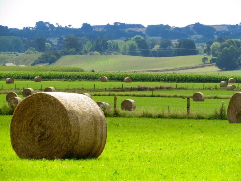
This shot, taken just south of Shannon, looks west across the terracelands above the Manawatu River as it meanders out to the Tasman Sea. Click here for map. Continue reading
This shot, taken just south of Shannon, looks west across the terracelands above the Manawatu River as it meanders out to the Tasman Sea. Click here for map. Continue reading

 The history and identity of the Horowhenua coastal town of Foxton is intrinsically linked to the Manawatu River. It was once a bustling port town, with ships loaded with flax, timber and other goods travelling down the river and out to markets in Wellington and beyond. While coastal shipping had largely ceased by the early 20th century, the wharf and the river that it served, was an integral part of the town’s identity and economy. Continue reading

 The Miranui flaxmill, located in the Makerua swamp just north of the Horowhenua town of Shannon, was once New Zealand’s largest flaxmill. The mill operated from 1907 to 1933, and had 19 mills, operating 42 flax-stripping machines and employing more than 700 workers during the height of the flax industry in 1916-17. Continue reading


My last post How did the Korean War change the NZ landscape? and specifically the mention of the demise of local dairy factories in the post-Korean War years, led me to think about ex-dairy factory towns and villages within my immediate orbit. One such place is in the northen Horowhenua village of Tokomaru, on the western side of the Tararua Ranges [click here to view map]. Continue reading

 I recently sent this photo from the envirohistory NZ banner to the Stirling University Research Centre for Environmental History and Policy to be used on their related links page. When I did so, I thought it may be a good opportunity to share the “back story” of the photo.
The photo is taken by veteran photographer, Paul Knight, of a farm just north of the Horowhenua town of Levin [click here to view location]. The farm, called Nikaunui, meaning “many (or big) nikau palms” in Maori, is a large sheep and beef farm, owned by the Kilsby family,* a family with a long history in the district. Continue reading

Like my earlier post with interesting cloud formation photos, this post is not – strictly speaking – about environmental history either, but I expect most readers will not quibble much, because these photos are very cool! Taken from veteran photographer Paul Knight’s back-yard, in Levin, Horowhenua, they capture the moon’s eclipse, which was visible in our skies on 21 December. It was, apparently, the first total lunar eclipse visible in New Zealand in three years. A total lunar eclipse only occurs when there is a full moon. The eclipse coincided with summer solstice – the shortest night/longest day in the year.

 The fact that the Horowhenua district has such a rich written and photographic history, as well as ethnographic, archaeological, cartographic and geological record, is almost wholly down to one man – a Horowhenua farmer and irrepressible self-taught scholar of geology, archaeology and ethnology (as well many other subjects). Indeed many of the photographs used on this site are the work of this highly methodical and observant man who took his camera everywhere – including up the Tararuas on numerous exploratory expeditions to map, make geological observations, rescue lost trampers or simply for adventure.
George Leslie Adkin was born in Wellington on 26 July 1888, the first of seven children of William George Adkin, a draper, and his wife, Annie Denton. Continue reading

![]() Episode 4 of the envirohistory NZ podcast series is now out. This episode explores three environmental histories – which, while diverse in both their time-spans and their human protagonists, are all connected by a common theme. The first of these stories begins in the early 1800s, and features a Maori hapu and its relationship with its coastal Horowhenua environment [click here to read original post]. The next one, is of pioneering Scottish settlers in the 1840s, and their longsighted protection of a remnant of swamp forest in what was to become Christchurch [click here to read original post]. The third and final, more recent, story is of a dairy farmer and the indigenous forest remnant encompassed by his south Waikato farm [click here to read original post]. Continue reading
Episode 4 of the envirohistory NZ podcast series is now out. This episode explores three environmental histories – which, while diverse in both their time-spans and their human protagonists, are all connected by a common theme. The first of these stories begins in the early 1800s, and features a Maori hapu and its relationship with its coastal Horowhenua environment [click here to read original post]. The next one, is of pioneering Scottish settlers in the 1840s, and their longsighted protection of a remnant of swamp forest in what was to become Christchurch [click here to read original post]. The third and final, more recent, story is of a dairy farmer and the indigenous forest remnant encompassed by his south Waikato farm [click here to read original post]. Continue reading

This photo is taken from State Highway 57 on the south-eastern side of Levin, in the southern North Island district of Horowhenua [click here to view approximate location]. In the foreground sheep graze, while the in the background, the bush-covered foothills of the Tararua Ranges, then the Ranges themselves – capped with a light sprinkling of the first winter snow – can be seen. Continue reading

 Papaitonga is a dune lake in the Horowhenua coastal plain. It is surrounded by a very rare remnant of coastal north island forest. Just south of Levin, the 135 hectare Papaitonga Scenic Reserve is a little known but ecologically and historically remarkable place [click here to view map].
The reserve contains the only intact sequence from wetland to mature dry terrace forest in Wellington and Horowhenua. It is an important refuge for birds that depend on wetlands or lowland forests for their survival. Papaitonga is home to waterfowl and wading birds as well as forest species on the lake’s margins. However, like many remnant wetland forests, the health of this wetland forest is threatened by a receding water table. The reserve is surrounded by farmland which draws on large volumes of water for irrigation. Continue reading


