I will be taking the audience on a journey of discovery of the Manawatu’s past through the photographs of C.E. Wildbore and others. The event also marks the launch of Totara Press’s beautiful new (French-flapped) edition of Ravaged Beauty: An environmental history.
Wildbore: A photographic legacy will also be for sale at the event.
The launch of “Wildbore: A photographic legacy” on Wednesday night was an amazing success, with over 80 people attending, including around 20 people from the wonderful Wildbore clan. Thank you all for coming along and making it such a successful and enjoyable event. Here are some photo highlights.
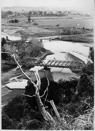
The old and new Raumai Bridges in 1973, before the old bridge was demolished. This view is looking north-west from No.4 Line. Palmerston North Library courtesy Manawatu Evening Standard
Those who have travelled up the eastern side of Pohangina Valley, to visit Totara Reserve, for example, will have crossed the Raumai Bridge. Those with more life experience may also the old Raumai Bridge, a bridge with a troubled past.Continue reading →
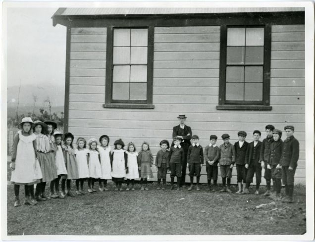
Teacher and pupils at Awahou South School, No. 4 Line, 1909. Palmerston North Library. Left to right: Norah Callesen, Annie Millen, Eileen Lynch, Kate Henson, Agnes Spelman, Kathleen (Gay) Spelman, Adelia (Delia) Spelman, Olive Hunt, Mary Leamy, Eileen Spelman, Mary Wellock, Albery Henson, Oscar (Tui) Callesen, Bernard Spelman, Unknown (Delph Spelman?), Tom Leamy, Cliff Spelman, Unknown x2, Henry Hunt. Teacher: Mr Lewis.
In 1977, an entire school house moved from its existing location on a country road in the shadow of the Ruahine Range in the Manawatu to the main street of Palmerston North City, nearly 30 kilometres away. To be fair, it was just a one-room school house, one of just over 40 square metres. The school was built in 1902, to take pupils within a 10-mile radius, who travelled to school by foot or pony. When it opened, it had a roll of 20, and by 1907, the number had increased to 32. Continue reading →
In a post last week I talked about my next book project, a book entitled WILDBORE: A photographic legacy, showcasing the photographs of pioneering farmer and bee-keeper of the Pohangina Valley.
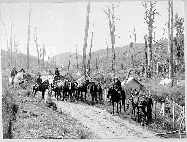
One of Charles E. Wildbore’s most evocative images (in a desolate kind of way) is this one of men getting ready to cart sleepers from Crown-owned reserve land in Pohangina Valley to the nearby railway station at Ashhurst. This road borders what is today known as Totara Reserve (originally set aside by the government for its timber), and is in fact not far from where I live. The other day, I drove up to the road in an effort to find the exact place he took the photograph – and was excited to locate it with relative ease. Well almost – judging from the terrain, the alignment of the road today is just to the south of its original route, on slightly higher ground.