In a post last week I talked about my next book project, a book entitled WILDBORE: A photographic legacy, showcasing the photographs of pioneering farmer and bee-keeper of the Pohangina Valley.
One of Charles E. Wildbore’s most evocative images (in a desolate kind of way) is this one of men getting ready to cart sleepers from Crown-owned reserve land in Pohangina Valley to the nearby railway station at Ashhurst. This road borders what is today known as Totara Reserve (originally set aside by the government for its timber), and is in fact not far from where I live. The other day, I drove up to the road in an effort to find the exact place he took the photograph – and was excited to locate it with relative ease. Well almost – judging from the terrain, the alignment of the road today is just to the south of its original route, on slightly higher ground.
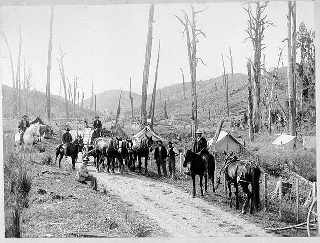

Top: Men carting railway sleepers on Opawe Rd, Pohangina Valley, circa 1904. Palmerston North Libraries. Above: Opawe Road today. In this image the Ruahine Range can be see very clearly, while in Wildbore’s photo the line of the range can only be seen very faintly. C. Knight
See also Wildbore’s landscapes and this recent feature in The Manawatu Standard.

